Notes:
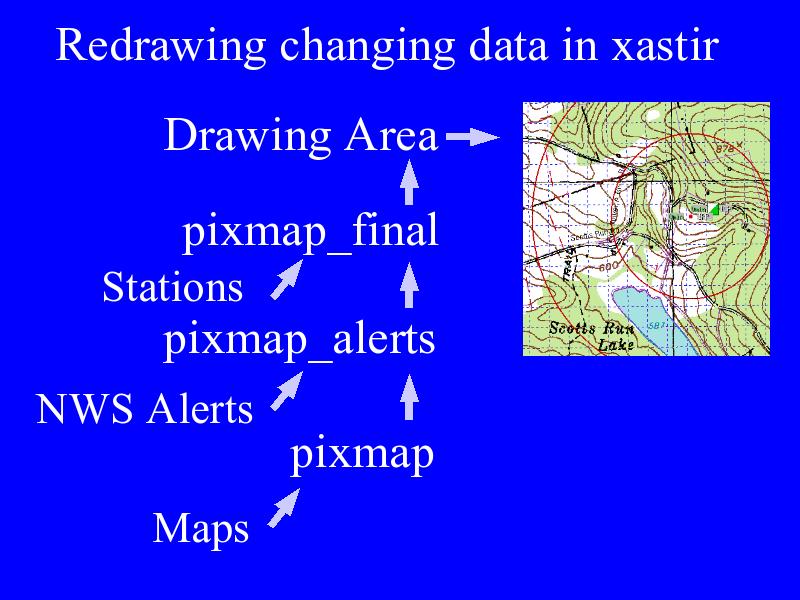
Plotted information changes at different rates. XASTIR avoids redrawing maps when ever new station data comes in by drawing maps into a pixmap and reusing that pixmap to draw new station locations.